Topology in GIS (Geographic Information Systems) refers to the spatial relationships between features, such as how points, lines, and polygons connect or relate to each other. It’s a crucial concept for ensuring data integrity, accuracy, and meaningful spatial analysis.
What Is Topology?
In the context of GIS, topology defines rules and behaviors about how spatial features interact. These rules ensure that spatial data maintains consistent relationships—for example:
- Lines connect properly at nodes
- Polygons close completely without gaps or overlaps
- No duplicate features exist
Why Topology Is Important in GIS
- Data Integrity
Prevents errors like gaps between adjacent polygons or overlapping boundaries in a land parcel map. - Efficient Spatial Analysis
Ensures correct results in operations like network analysis, spatial joins, or overlay operations. - Real-World Accuracy
Helps maintain the logical relationships found in the real world, such as streets connecting at intersections.
Common Topological Rules
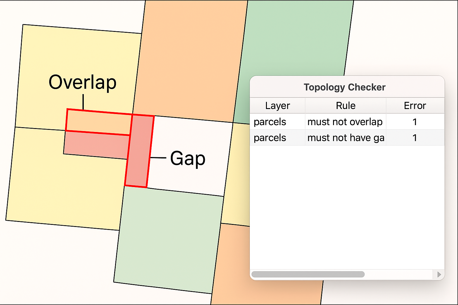
- Must Not Overlap (Polygons) – Two land parcels should not occupy the same space.
- Must Not Have Gaps (Polygons) – No empty spaces between adjacent polygons in a zoning map.
- Must Be Covered By (Lines) – E.g., all roads must be within a road network layer.
- Must Not Self-Intersect (Lines) – A river or road should not cross itself.
Applications of Topology
- Cadastral mapping: Ensures property boundaries don’t overlap or leave gaps.
- Utility networks: Ensures that all pipes or cables are properly connected.
- Transportation: Validates road connectivity and routing accuracy.
- Environmental management: Maintains accurate boundaries for ecosystems or habitats.
Tools for Topology in GIS Software
- ArcGIS (ESRI): Has a Topology Toolset for creating and validating topology rules.
- QGIS: Offers Topology Checker plugin and geometry validation tools.
- PostGIS: A spatial extension of PostgreSQL that supports topological data structures.
An actual image or diagram showing overlapping and gapped polygons