
Personal Fitness Tracking GIS Analysis: Revolutionizing Health Through Geographic Intelligence
The intersection of personal fitness tracking and Geographic Information Systems (GIS) represents a transformative approach to understanding health and wellness patterns. As wearable technology becomes ubiquitous and location-aware devices generate unprecedented amounts of spatial health data, GIS analysis emerges as a powerful tool for extracting meaningful insights from personal fitness information. This convergence enables individuals, healthcare professionals, and researchers to visualize, analyze, and understand the geographic dimensions of physical activity, creating new opportunities for personalized health interventions and community wellness initiatives.
Personal fitness tracking has evolved from simple pedometers to sophisticated multi-sensor devices capable of monitoring heart rate, sleep patterns, stress levels, and precise location data. When combined with GIS analytical capabilities, this data transforms from isolated metrics into rich spatial narratives that reveal how our environment influences our health behaviors and outcomes.
The Evolution of Fitness Tracking Technology
The journey from basic step counters to today’s advanced fitness tracking ecosystems reflects rapid technological advancement and changing consumer expectations. Early fitness trackers focused primarily on counting steps and estimating calories burned, providing users with basic activity summaries. Modern devices integrate GPS receivers, accelerometers, gyroscopes, heart rate monitors, and environmental sensors to create comprehensive pictures of user activity and physiological responses.
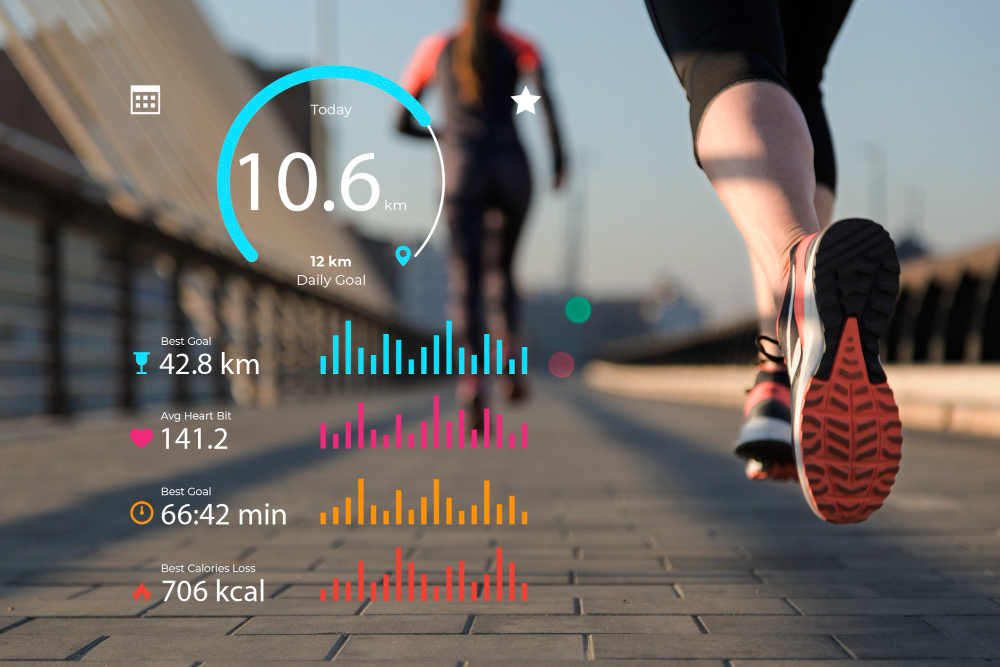
Contemporary fitness trackers collect location data with remarkable precision, often recording GPS coordinates every few seconds during activities. This spatial granularity, combined with temporal information and physiological measurements, creates rich datasets perfect for GIS analysis. The integration of smartphone applications further enhances data collection by adding social features, manual activity logging, and integration with other health monitoring systems.
The proliferation of fitness tracking platforms has democratized access to personal health data while simultaneously creating vast repositories of spatial health information. Major platforms process billions of data points daily, creating opportunities for both individual analysis and population-level health research.
Fundamentals of GIS in Health Analytics
Geographic Information Systems provide the technological framework necessary to process, analyze, and visualize spatial health data effectively. GIS combines spatial data management, analytical tools, and visualization capabilities to reveal patterns and relationships that might remain hidden in traditional tabular data analysis.
In the context of personal fitness tracking, GIS serves multiple functions. It manages the complex spatial datasets generated by fitness devices, provides tools for spatial analysis such as route optimization and environmental correlation, and creates intuitive visualizations that help users understand their activity patterns. The spatial component adds crucial context to fitness data, transforming simple metrics into geographically-aware insights.
Core GIS concepts particularly relevant to fitness tracking include spatial autocorrelation, which helps identify clustering of similar activities or performance levels; buffer analysis for understanding the influence of environmental features on exercise behavior; and network analysis for route optimization and accessibility studies. These analytical capabilities enable sophisticated examination of how geographic factors influence fitness outcomes.
The temporal dimension of fitness data adds another layer of complexity that GIS handles effectively. Spatiotemporal analysis techniques allow for the examination of how fitness patterns change over time and space, revealing seasonal variations, long-term trends, and the impact of life events on exercise habits.
Data Collection and Management
Effective GIS analysis of personal fitness data begins with robust data collection and management strategies. Modern fitness tracking devices generate multiple data streams simultaneously, each with different spatial and temporal resolutions. GPS tracks provide location information, while accelerometer data captures movement patterns, and heart rate monitors record physiological responses.
Data quality represents a critical consideration in fitness tracking GIS analysis. GPS accuracy varies significantly based on environmental conditions, with urban canyons, forest canopies, and weather conditions all potentially affecting location precision. Understanding these limitations is essential for meaningful analysis, as is implementing appropriate data cleaning and validation procedures.
The integration of multiple data sources enhances analytical capabilities while introducing complexity. Fitness trackers, smartphone applications, and manual logs each contribute different types of information that must be harmonized for effective analysis. This process often involves temporal synchronization, spatial alignment, and data format standardization.
Privacy and data security considerations are paramount when managing personal fitness data. Spatial health information is inherently sensitive, revealing detailed patterns about individual behavior, health conditions, and daily routines. Effective data management strategies must balance analytical utility with privacy protection, often involving data anonymization, aggregation, and secure storage protocols.
Spatial Analysis Techniques
Personal fitness tracking data lends itself to numerous spatial analysis techniques that reveal insights impossible to obtain through traditional statistical methods. Hot spot analysis identifies areas of high or low activity intensity, helping users understand which locations promote or inhibit physical activity. These analyses can reveal the impact of environmental features such as parks, hills, or traffic patterns on exercise behavior.
Route analysis represents another powerful application of spatial techniques to fitness data. Optimal route identification helps users find the most efficient or enjoyable paths for running, cycling, or walking. Analysis of route characteristics such as elevation profiles, surface types, and environmental conditions provides insights into factors that influence exercise performance and enjoyment.
Accessibility analysis examines how easily users can reach exercise facilities, trails, or other fitness resources from their home or work locations. This type of analysis is particularly valuable for understanding barriers to physical activity and identifying underserved areas that might benefit from additional fitness infrastructure.
Proximity analysis explores relationships between fitness activities and environmental features. For example, analysis might reveal correlations between proximity to green spaces and exercise frequency, or between air quality measurements and outdoor activity patterns. These insights can inform both personal exercise decisions and public health policy.
Clustering analysis identifies groups of similar activities or locations, helping users understand their exercise patterns and preferences. Temporal clustering might reveal daily or seasonal activity patterns, while spatial clustering could identify preferred exercise areas or routes.
Environmental Factors and Their Impact
The environment plays a crucial role in fitness behavior, and GIS analysis provides powerful tools for quantifying these relationships. Topographic analysis examines how elevation, slope, and terrain characteristics influence exercise patterns and performance. Runners might discover their preferred routes avoid steep hills, while cyclists might find they perform better on certain gradient ranges.
Weather integration adds another dimension to fitness analysis. By combining location-specific weather data with activity information, users can understand how temperature, precipitation, humidity, and wind affect their exercise patterns and performance. This analysis might reveal optimal conditions for different activities or help predict how weather changes might impact fitness routines.
Air quality represents an increasingly important environmental factor in fitness planning. Integration of air quality monitoring data with fitness tracking information allows users to understand how pollution levels affect their outdoor activities and health outcomes. This analysis is particularly valuable in urban environments where air quality varies significantly by location and time.
Land use and urban design features significantly influence fitness behavior. GIS analysis can quantify relationships between fitness activities and features such as parks, sidewalk networks, bicycle infrastructure, and commercial development patterns. Understanding these relationships helps individuals optimize their exercise environments and informs community planning decisions.
Natural environmental features such as proximity to water bodies, forest cover, and biodiversity can also influence fitness patterns. Analysis might reveal that activities near water increase motivation and duration, or that diverse natural environments promote more varied exercise routines.
Health Outcome Analysis
The ultimate goal of fitness tracking GIS analysis often involves understanding relationships between spatial factors and health outcomes. By combining location-aware fitness data with health metrics, researchers and individuals can identify environmental factors that promote or hinder health improvement.
Cardiovascular response analysis examines how location and environmental conditions affect heart rate patterns during exercise. This analysis might reveal that certain routes or environments consistently produce better cardiovascular training effects, or identify locations where users experience unusually high stress responses.
Performance trend analysis tracks changes in fitness metrics across different locations and time periods. Users might discover that their running performance improves in certain areas due to favorable terrain, air quality, or psychological factors associated with particular environments.
Recovery pattern analysis examines how location and environmental factors influence post-exercise recovery. This might involve analyzing sleep quality following activities in different environments or tracking how quickly fitness metrics return to baseline levels after exercises in various locations.
Injury risk assessment represents another important application of health outcome analysis. By examining relationships between activity locations, environmental conditions, and injury occurrence, users can identify high-risk situations and modify their behavior accordingly.
Case Studies and Applications
Real-world applications of personal fitness tracking GIS analysis demonstrate the practical value of these techniques across diverse contexts and user groups. Urban runners have used GIS analysis to identify optimal routes that balance distance requirements with air quality, safety, and scenic value. By analyzing historical performance data alongside environmental variables, runners can select routes that maximize both training effectiveness and enjoyment.
Cycling enthusiasts have employed spatial analysis to understand how terrain characteristics affect their performance and route preferences. Analysis of elevation profiles, road surface types, and traffic patterns helps cyclists plan routes that match their fitness goals and risk tolerance. Long-term analysis reveals how route selection strategies evolve with improving fitness levels.
Healthcare applications of fitness tracking GIS analysis include cardiac rehabilitation programs that use spatial data to design safe, effective exercise routines for patients with heart conditions. By analyzing how patients respond to different environmental conditions and route characteristics, healthcare providers can develop personalized exercise prescriptions that optimize health outcomes while minimizing risks.
Corporate wellness programs have implemented GIS analysis of employee fitness data to understand how workplace location and surrounding environment affect physical activity levels. These analyses inform decisions about office location, facility design, and wellness program structure to maximize employee health benefits.
Research applications include population health studies that use aggregated fitness tracking data to understand how community design and environmental factors influence physical activity patterns. These studies inform urban planning decisions and public health interventions designed to promote community-wide fitness improvement.
Technology and Tools
The implementation of personal fitness tracking GIS analysis requires integration of diverse software tools and platforms. Consumer-grade fitness applications increasingly incorporate basic spatial analysis features, allowing users to visualize their activities on maps and track performance across different routes and locations.
Professional GIS software platforms provide more sophisticated analytical capabilities for users requiring advanced spatial analysis. These tools support complex spatial queries, statistical analysis, and custom visualization creation that goes beyond the capabilities of standard fitness applications.
Cloud-based platforms have emerged as popular solutions for fitness data analysis, providing scalable computational resources and integrated analytical tools. These platforms often include APIs that facilitate integration with various fitness tracking devices and applications, simplifying data collection and analysis workflows.
Mobile applications specifically designed for fitness GIS analysis combine field data collection capabilities with analytical tools, allowing users to conduct spatial analysis directly from their smartphones or tablets. These applications are particularly valuable for real-time decision making during exercise activities.
Open-source tools provide cost-effective alternatives for users interested in conducting sophisticated fitness GIS analysis without the expense of commercial software. These tools often offer extensive customization capabilities and active community support for specialized applications.
Challenges and Limitations
Despite its significant potential, personal fitness tracking GIS analysis faces several important challenges and limitations. Data quality issues represent perhaps the most significant challenge, as GPS accuracy, sensor calibration, and data consistency can significantly impact analysis results. Users must understand these limitations and implement appropriate quality control measures.
Privacy concerns present ongoing challenges for fitness data analysis, particularly when data is shared or aggregated for research purposes. Balancing analytical utility with privacy protection requires careful consideration of data handling procedures and user consent processes.
Technical complexity can limit accessibility of advanced GIS analysis techniques for casual users. While basic spatial visualization has become commonplace, more sophisticated analysis often requires specialized knowledge and software that may be beyond the reach of typical fitness tracking users.
Data integration challenges arise when combining information from multiple sources with different formats, coordinate systems, and temporal resolutions. Effective integration often requires significant preprocessing and standardization efforts.
Interpretation challenges can lead to incorrect conclusions if users lack sufficient understanding of spatial analysis principles and limitations. Statistical significance, spatial autocorrelation, and other analytical concepts require careful consideration to avoid misinterpretation of results.
Future Directions and Emerging Trends
The future of personal fitness tracking GIS analysis promises exciting developments across multiple dimensions. Artificial intelligence integration will enable more sophisticated pattern recognition and predictive analysis, helping users optimize their fitness routines based on complex spatial and temporal patterns.
Real-time analysis capabilities will allow for dynamic route optimization and environmental adaptation during exercise activities. Users will receive immediate feedback about optimal routes, pace adjustments, and environmental conditions to maximize their workout effectiveness.
Internet of Things (IoT) integration will expand the range of environmental data available for fitness analysis. Smart city infrastructure, wearable air quality monitors, and environmental sensor networks will provide unprecedented spatial detail about conditions affecting fitness activities.
Augmented reality applications will overlay analytical results directly onto users’ visual environment, providing intuitive access to spatial fitness insights during activities. Users might see optimal routes, performance predictions, or environmental information displayed in their field of view through smart glasses or mobile devices.
Social fitness analysis will examine how group activities and social networks influence fitness patterns across space and time. This analysis will reveal how social factors interact with environmental conditions to shape exercise behavior and health outcomes.
Precision medicine applications will use individual fitness tracking GIS data to develop highly personalized health interventions that account for genetic factors, health history, and environmental exposure patterns. This approach promises to optimize health outcomes through spatially-aware, individually-tailored recommendations.
Conclusion
Personal fitness tracking GIS analysis represents a powerful convergence of technology, health science, and geographic analysis that offers unprecedented insights into the spatial dimensions of physical activity and health. By combining location-aware fitness data with sophisticated spatial analysis techniques, individuals and researchers can understand how environmental factors influence exercise behavior, performance, and health outcomes.
The integration of GIS capabilities with personal fitness tracking creates opportunities for more effective, personalized approaches to health improvement. Users can optimize their exercise routines based on detailed understanding of how location, environment, and spatial patterns affect their fitness goals. Healthcare providers can develop more effective interventions that account for patients’ environmental contexts and spatial behavior patterns.
As technology continues to advance and data quality improves, personal fitness tracking GIS analysis will become increasingly sophisticated and accessible. The emergence of real-time analysis, artificial intelligence integration, and expanded environmental monitoring will further enhance the value of spatial approaches to fitness and health analysis.
The success of these applications depends on continued attention to data quality, privacy protection, and analytical rigor. Users must understand both the capabilities and limitations of spatial analysis techniques to derive meaningful insights from their fitness data. As these tools become more sophisticated, education and support resources will be essential to ensure effective and appropriate use.
Personal fitness tracking GIS analysis ultimately represents more than a technological advancement; it embodies a fundamental shift toward understanding health and fitness as inherently spatial phenomena. By recognizing and analyzing the geographic dimensions of physical activity, we can develop more effective strategies for promoting individual and community health, creating environments that support active lifestyles, and addressing health disparities that have spatial components.
The future of personal health may well depend on our ability to understand and optimize the complex relationships between our bodies, our activities, and our environments. GIS analysis of personal fitness tracking data provides essential tools for navigating this complexity and developing more effective, spatially-aware approaches to health and wellness.
