OS Code-Point Open Postcode Mapping Data
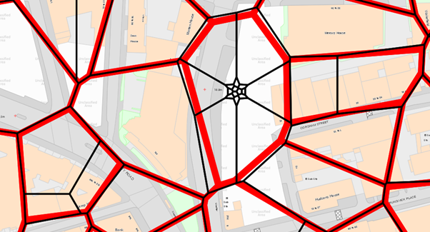
Ordnance Survey’s Code-Point® Open is an open dataset of all the current postcode units in Great Britain. Code-Point Open locates over 1.7 million postcode units for Great Britain, each having a notional geographical location. This makes it one of the most comprehensive and authoritative sources of UK postcode location data available for free use.
Key Features and Specifications
Dataset Coverage
- Geographic Scope: Great Britain (England, Scotland, and Wales)
- Total Records: Over 1.7 million postcode units
- Precision: Each postcode has a precise geographic location at a resolution of 1 metre
- Address Coverage: Postcode units are unique references and identify an average of 15 addresses
Data Attributes
For each postcode unit, Code-Point Open provides:
- Postcode Unit: The full postcode (e.g., SW1A 1AA)
- Geographic Coordinates:
- British National Grid (Easting/Northing)
- Latitude/Longitude (WGS84)
- Administrative Boundaries:
- Country code, NHS area code along with local government county, district, and ward codes
- Data Quality Indicators:
- Positional quality indicator (PQI) showing the accuracy of the coordinate placement
Update Schedule
This product is updated quarterly in February, May, August, and November, ensuring that the dataset remains current with new postcode allocations and changes to existing ones.
Technical Implementation
Data Formats
The dataset is available in multiple formats:
- CSV (Comma Separated Values)
- Shapefile (.shp)
- GML (Geography Markup Language)
- Various GIS-compatible formats
Coordinate Systems
- Primary: British National Grid (OSGB36)
- Alternative: WGS84 decimal degrees for international compatibility
File Structure
The data is typically organized by postcode area (the first 1-2 letters of the postcode) to make downloads more manageable and allow users to access only the geographic regions they need.
Use Cases and Applications
Geographic Information Systems (GIS)
Code-Point Open serves as a foundational layer for:
- Location-based analysis
- Service area mapping
- Demographic studies
- Market research and business intelligence
Web Mapping and Applications
- Postcode geocoding services
- Address validation systems
- Delivery route optimization
- Store locator functionality
Statistical Analysis
- Census data mapping
- Health service planning
- Educational catchment analysis
- Electoral boundary studies
Advantages of Code-Point Open
Cost-Effective Solution
Being an open dataset, Code-Point Open provides significant cost savings compared to commercial postcode databases while maintaining high accuracy and coverage.
Official Source
As an Ordnance Survey product, it represents the authoritative source for UK postcode locations, ensuring reliability and consistency.
Regular Updates
Quarterly updates ensure that new developments, postcode changes, and administrative boundary modifications are reflected promptly.
Comprehensive Coverage
Unlike some commercial alternatives that may exclude certain postcode types, Code-Point Open includes all current postcode units in Great Britain.
Limitations and Considerations
Geographic Scope
The dataset covers Great Britain only. Northern Ireland postcodes are available in the commercial Code-Point product but not in the open version.
Positional Accuracy
While generally highly accurate, the positional quality varies depending on the source data used to determine postcode locations. The PQI indicator helps users understand this variability.
Large User Postcodes
Some postcodes serve single large organizations or businesses, which may affect the representativeness of the location for general geographic analysis.
Access and Download
OS Data Hub
The primary access point is through the Ordnance Survey Data Hub, which provides:
- Direct download capabilities
- API access for automated retrieval
- Data package creator for custom extracts
- Integration with various GIS platforms
Licensing
Code-Point Open is released under the Open Government Licence, allowing free use for both commercial and non-commercial purposes with appropriate attribution.
Integration Best Practices
Data Processing
When working with Code-Point Open data:
- Validate postcode formats before geocoding
- Consider the positional quality indicator for accuracy requirements
- Account for coordinate system transformations if using international standards
- Implement regular update procedures to maintain currency
Performance Optimization
For large-scale applications:
- Index postcode fields for rapid lookup
- Consider spatial indexing for geographic queries
- Implement caching strategies for frequently accessed postcodes
- Use regional subsets where full national coverage isn’t required
Quality Assurance
- Cross-reference with other authoritative sources where critical accuracy is required
- Implement validation routines for coordinate reasonableness
- Monitor for anomalies in postcode-to-location mappings
Related Ordnance Survey Products
Code-Point (Commercial)
The commercial version extends coverage to Northern Ireland and provides additional attributes and more frequent updates.
AddressBase Products
For applications requiring full address details rather than just postcode locations, AddressBase products provide comprehensive property-level information.
OS Code-Point Open represents an exceptional resource for anyone working with UK geographic data. Its combination of comprehensive coverage, regular updates, authoritative sourcing, and open licensing makes it an invaluable tool for developers, researchers, and organizations requiring reliable postcode location data. Whether used for simple address validation or complex spatial analysis, Code-Point Open provides the foundation for location-based applications across Great Britain.
The dataset’s accessibility through modern web services, combined with its technical robustness and regular maintenance, ensures it remains a cornerstone resource for the UK’s geographic information infrastructure.

